
In a massive leap for geospatial technology, Google Research has officially introduced S2Vec, a self-supervised AI framework designed to understand the “built environment” of our world. By transforming complex map data into digital summaries, S2Vec allows AI to recognize patterns in neighborhoods just like a human would, marking a new era for urban planning and smart city development.
How S2Vec Works: Mapping the Urban DNA
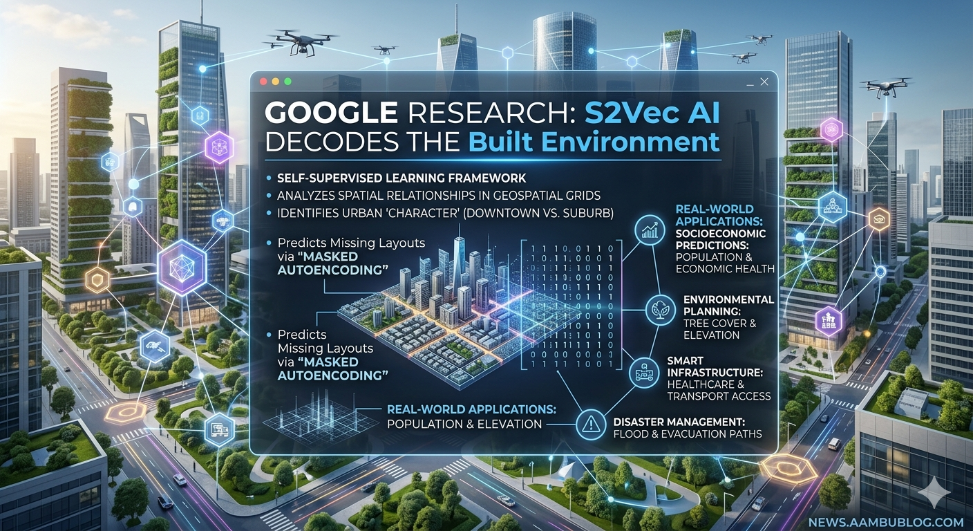
Traditional AI often struggles to understand the relationship between different physical objects on a map. S2Vec (Spatial-to-Vector) solves this by dividing geographic areas into fine-grained grids. It then analyzes features like the distribution of housing, roads, parks, and businesses within those grids.
Through a technique called “Masked Autoencoding,” the AI learns to predict missing parts of a city’s layout, effectively learning the “language” of how cities are structured. This allows the model to capture the unique “character” of any urban area, from a dense downtown core to a sprawling suburb.
Key Capabilities and Real-World Impact
The introduction of S2Vec is not just a technical achievement; it has practical applications that could change how we live:
- Socioeconomic Predictions: S2Vec can predict population density and economic health by simply looking at the layout of the built environment.
- Environmental Planning: It helps researchers understand tree cover and elevation patterns, which is critical for fighting climate change.
- Smart Infrastructure: Urban planners can use S2Vec to identify under-served areas that need better public transport or more hospitals.
- Disaster Management: By understanding the “DNA” of a city, S2Vec can help predict how floods or other disasters might move through a specific neighborhood, saving lives through better evacuation planning.
Why This Matters for news.aambublog.com Readers
As we move toward a more urbanized world, the ability to “decode” our cities becomes vital. Google’s S2Vec isn’t just about maps; it’s about using AI to make our cities more livable, sustainable, and efficient. For tech enthusiasts and developers, this represents a shift away from niche, hand-crafted models toward a more general form of Geospatial AI.
Frequently Asked Questions (FAQs)
1. Is S2Vec just a new version of Google Maps?
No. While it uses map data, S2Vec is a deep-learning framework that “understands” the relationships between objects (like roads and buildings) to predict future trends, whereas Google Maps is primarily for navigation.
2. How does S2Vec help in fighting climate change?
By analyzing urban density and green spaces, S2Vec can help planners design “cooler” cities that require less energy for cooling and have better management of natural resources.
3. Will S2Vec be available for developers?
Google Research often open-sources its frameworks. While S2Vec is currently a research breakthrough, it is expected to influence future Google Cloud and Earth Engine tools for developers and governments.
4. Can S2Vec predict traffic jams?
Indirectly, yes. By understanding the layout and “character” of a city’s streets and businesses, it can provide the foundational data needed to build more accurate traffic and movement models.
Editor’s Note: This breakthrough confirms that AI is moving beyond just text and images into the physical world we inhabit. Stay tuned to news.aambublog.com for more updates on Google’s Earth AI innovations.