
Google Research has officially introduced its latest innovation in Artificial Intelligence, a model named S2Vec. This sophisticated AI is designed to understand what researchers call the “language of cities” by analyzing complex spatial data. The goal is to help urban planners and governments build smarter, more efficient cities.
How S2Vec Works
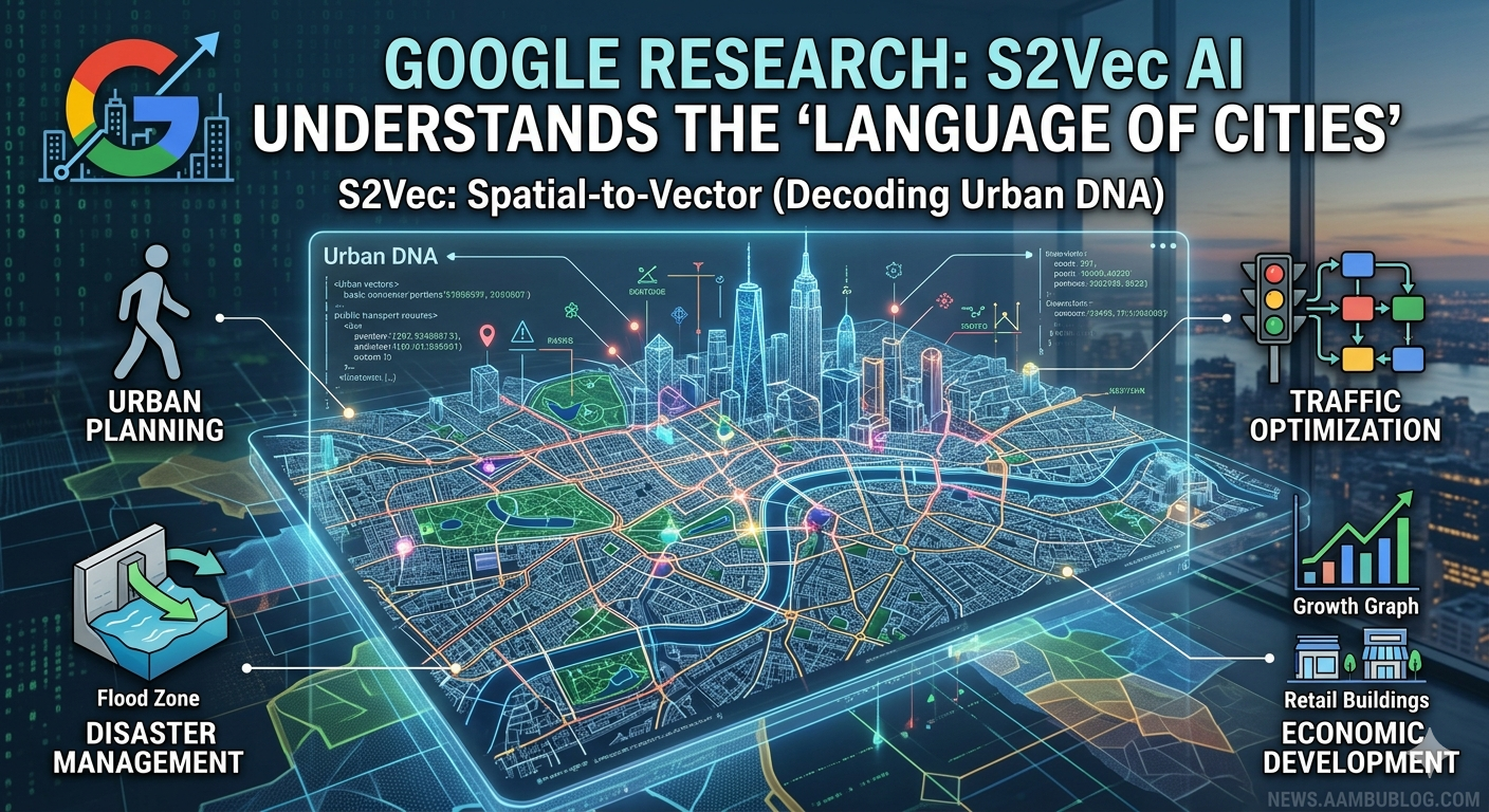
Unlike traditional AI models that focus on text or images, S2Vec (Spatial-to-Vector) focuses on geographic and spatial patterns. It looks at how streets, buildings, parks, and transportation hubs are connected. By converting these physical layouts into digital “vectors,” the AI can predict how a city might grow or where problems like traffic congestion and poor drainage are likely to occur.
Google’s researchers believe that by understanding the “DNA” of a city through S2Vec, they can provide insights that were previously impossible to calculate. This model doesn’t just see a map; it understands the relationship between different urban elements.
Key Applications of S2Vec AI
The introduction of S2Vec is expected to revolutionize several sectors:
- Urban Planning: Helping architects and city councils design neighborhoods that are more walkable and sustainable.
- Disaster Management: Predicting how floods or fires might spread through specific urban layouts, allowing for faster evacuation plans.
- Traffic Optimization: Improving public transport routes by analyzing real-world movement patterns.
- Economic Development: Identifying under-served areas that need more infrastructure or commercial investment.
The Future of Smart Cities
This breakthrough is a major step toward the development of “Digital Twins”—virtual copies of real cities that can be used to test new policies before they are implemented. As global populations continue to shift toward urban areas, tools like S2Vec will be essential for managing resources and ensuring a high quality of life in densely populated regions.
Frequently Asked Questions (FAQs)
1. What is Google S2Vec?
S2Vec is a new AI model from Google Research that analyzes spatial and geographic data to understand urban patterns and city layouts.
2. Is S2Vec like Google Maps?
While it uses geographic data, S2Vec goes beyond mapping. It uses machine learning to predict growth and simulate urban scenarios, whereas Google Maps is primarily for navigation and visualization.
3. Who can benefit from this technology?
Government agencies, urban planners, environmental researchers, and logistics companies are the primary users of this AI technology.
4. Will S2Vec be available to the public?
Currently, S2Vec is part of Google’s research initiatives. While the core technology might be integrated into future Google Cloud services for developers, it is currently being used for research and planning purposes.